|
||||
|
||||
|
||||||||||||||||
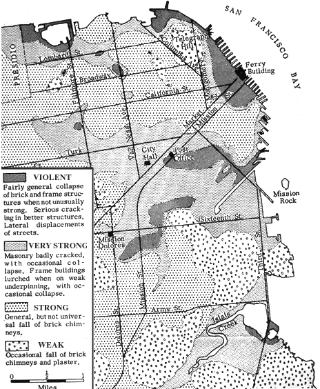 Fig. 1. Map of portion of San Francisco, showing 1906 apparent earthquake intensity. San Andreas Fault located about 10 miles west of Ferry Building. Note large variations in intensity for areas approximately same distance from the fault. "Violent" areas associated with poorest ground areas. IN: The California earthquake of April 18, 1906. Washington, D.C., Carnegie Institution of Washington, 1908-10. |